
Gatuncillo Fm
Type Locality and Naming
- Thompson (1944) named the shale “Gatuncillo Shale” which consists of thick sequence of soft, finely bedded, uniformly fine, and even grained yellowish-gray or buff-colored shales and impure bentonite beds with occasional thin siltstone layers. Overlies basement complex. Older than Quebrancha limestone (new). Many forms of microfossils are related to those identified from the so-called Tranquilla shales of upper Eocene age, which formerly cropped out within Madden Reservoir Basin now inundated.
- Woodring & Thompson (1949) first published it as Gatuncillo Fm and states that at the type region, it consists chiefly of mudstone, siltstone, impure bentonite, and thin lenses of limestone. Unless it is duplicated by faults, which would be difficult to detect, its thickness is as much as 3,000 feet. Unconformably overlies basement complex (made up principally of altered volcanics); underlies Bohío Fm. Upper Eocene. Name Tranquilla shale was proposed for late Eocene strata in Madden Basin (Coryell et al. (1937b)). That name was inadequately defined, and specified type locality is now flooded by Madden Lake. The “Tranquilla Shale” is now included within the Gatuncillo Fm.
- The type region is the Quebrancha syncline.
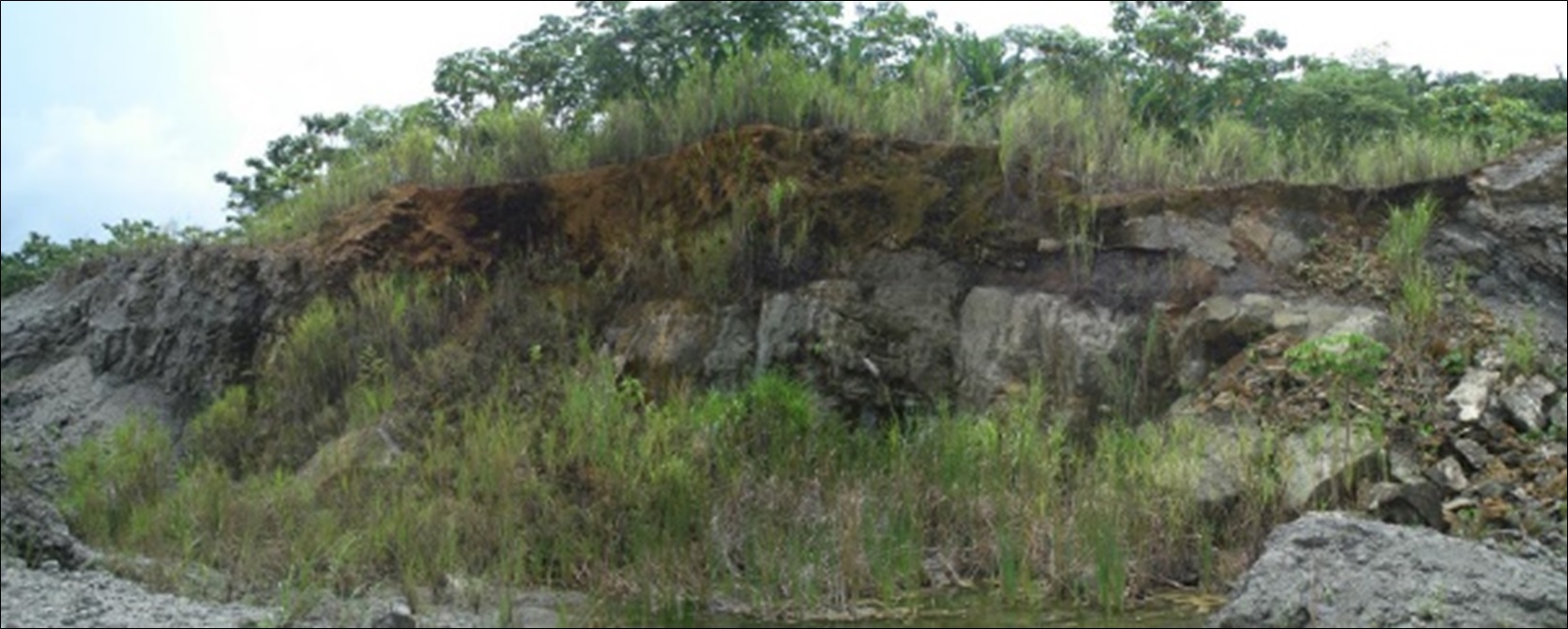
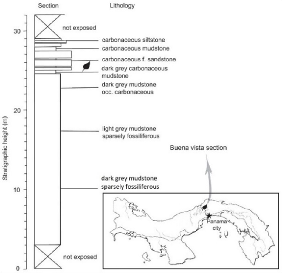
- Erdei et al. (2018)’s cycad locality is 1.5 km South of Buena Vista, on the NE side of the Madden-Colón road (Transisthmica), and 46 km SE of Colón (9°16´4.80˝N, 79°41´15.83˝W). This section has now been destroyed through continued quarrying of rock for construction fill, but previously exposed some 20 m of mudstone and carbonaceous sandstone (Figure 098).
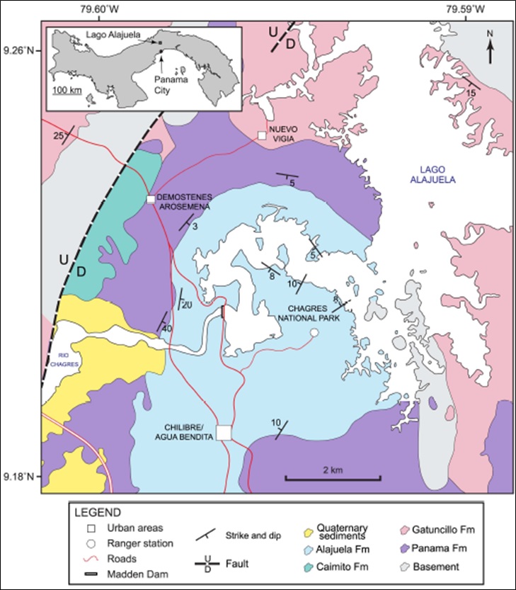
[Figure 1. Geological map of Lago Alajuela region (previously Lake Madden). MacFadden et al. (2017).]
[Figure 2. Outcrop located at abandoned quarry on the new highway to Colón. Gray, slightly calcareous siltstones underlying foraminiferal limestones of the Gatuncillo Fm. Ramirez (2013).]
Synonym: Gatuncillo Shale, Tranquilla Shale, Río Duque Shales.
Lithology and Thickness
The formation outcrops around Lake Alahuela north of Panama City. The Río Gatún fault terminates the exposure to the north, and the Azota fault defines portions of its western limits. A few isolated outcrops occur to the west along Gatún Lake and at the north end of Culebra Reach. Elsewhere the formation has been identified in cores to the south as far as Gold Hill and north of Gamboa. In addition, it has been recognized eastward into the Bayano River Basin and westward as far as the Costa Rica-Panama border. There are also massive outcrops in the southern part of the Azuero Peninsula (Graham et al. (1985)).
Surrounding most of the Gatuncillo Fm to the east, north, and west are extensive areas mapped as pre-Cenozoic. These include altered basaltic and andesitic lavas and tuff, and other dioritic and dacitic intrusives (Graham et al. (1985)).
Thickness: 150-800m
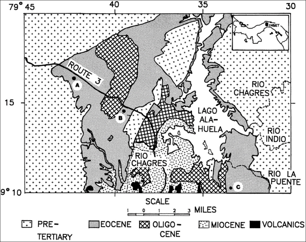
[Figure 3. Map of Budd et al. (1992)'s coral collecting area. The three towns indicated are: A- Buena Vista; B- Gatuncillo; C- Calzada Larga.]
[Figure 4: Erdei et al. (2018)’s geological section of the Gatuncillo Fm. The leaf symbol indicates layers yielding plant fossils including Cycads (Zamia nelliaea).]
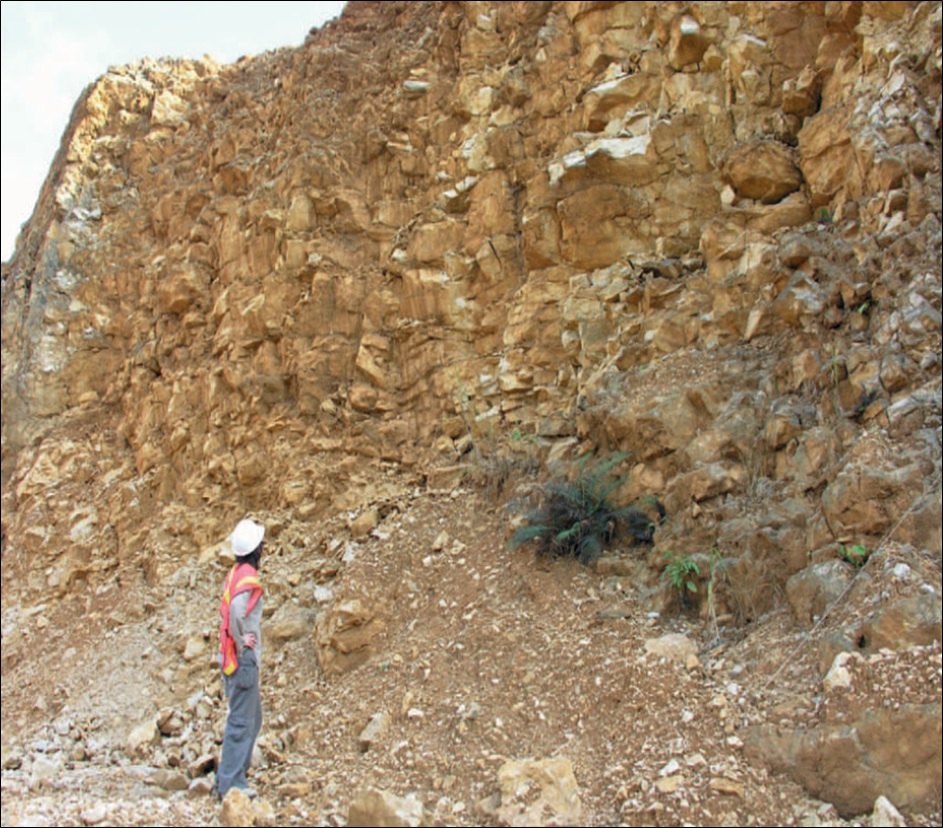
[Figure 5: Quarry showing a limestone outcrop of the Gatuncillo Fm near the Panama Canal, Upper Eocene. Barat (2013).]
Relationships and Distribution
Lower contact
Upper contact
Regional extent
GeoJSON
Fossils
Samples for pollen and spore analysis were obtained from a roadcut section near Alcalde Diaz just off the Boyd-Roosevelt highway (9°7'N, 79°32'W). The concurrence of the mollusk and foraminifera data, in the absence of any conflicting stratigraphic information, indicates the palynomorphs recovered from the Gatuncillo Fm represent remnants of a middle to late Eocene plant community growing in the region approximately 40 Ma (Graham et al. (1985)).
Cadena et al. (2012) describe turtles. Corals (at least 43 species of 25 genera) (Budd et al. (1992)); Cycads (Zamia) (Erdei et al. (2018)). Compression fossils of various plants were collected at Erdei et al. (2018)’s locality from a steeply dipping carbonaceous sandstone bed, along with infrequent molds of bivalves and gastropods of nearshore affinity. These overlay a thick succession of mudstone, with sparse mollusks, including nuculanid and corbulid bivalves, turrid gastropods, Dentalium (Scaphopoda), and Aturia (Cephalopoda). This fauna, together with the fine and massive siliciclastic sediments indicate an offshore (mid-shelf to outer shelf) setting for the overlying mudstone facies. Budd et al. (1992) states that less commonly associated with the limestones of the Gatuncillo Fm are echinoid- or coral-rich beds. Cooke (1948) describes these echinoids while Woodring (1957) provides a spectacular sample (Figure 6).
[Figure 6: Echinoids (Cubanaster aruñai) from the Gatuncillo Fm. Woodring (1957)]

Age
Depositional setting
Additional Information
References:
- Coryell et al. (1937b); Cooke (1948); Cole (1953); Wilson et al. (1957);
- Woodring (1957). Middle and upper Eocene.
- Woodring (1959)
- Woodring (1960). Mudstone and siltstone are the prevailing lithologic types, but the formation includes sandstone, conglomerate, and limestone. The Gatuncillo is widely distributed in the eastern part of the Canal Zone and in Panama east of the Zone. The fossils include foraminifera, corals, mollusks, and echinoids: Bulimina jacksonensis, Hantkenina alabamensis, Yaberinella jamaicensis, Fabiania cubensis, Helicostegina soldadensis, Lepidocyclina pustulosa, L. chaperi, Asterocyclina georgiana, Velates cf. perversus, Ectinochilus cf. gaudichaudi, Corbis cf. jamaicensis, Peronella acunai, and Eupatagus clevei. According to these fossils, middle and late Eocene are represented.
- Woodring (1964, 1973, 1982); Graham (1984); Graham et al. (1985); Budd et al. (1992); Tripati & Zachos (2002); Montes et al. (2010); Cadena et al. (2012); Ramirez (2013); Barat et al. 2014; Ramirez et al. (2016); Erdei et al. (2018); Redwood (2019);